Sun Stone City Pamulapadu. CRDA Approved Venture in Pamulapadu, Tadikonda Mandal
Sun Stone City Pamulapadu
Sun Stone City by Realest Builders is a Proposed CRDA Venture
in Pamulapadu, Tadikonda Mandal, Guntur District
Amaravati,The capital city of Andhra Pradesh
Amaravathi is rapidly developing into a worldclass capital.
Strategically located between the Inner Ring Road and Outer Ring Road,
Amaravati offers a unique opportunity for customers to double their investment quickly.
Strategically located between the Inner Ring Road and Outer Ring Road of the
capital city, our 35 acre premium project "Sunstone
City" by Realest Builders is part of a A 100 acres Mega Gated
Community Premium Residential Villa Plotting at A.P CAPITAL AMARAVATI. PHASE 1in
35 acres CRDA, RERA proposed being developed in a prime location in Pamulapadu,
adjacent to the 3,500 acre IT corridor.
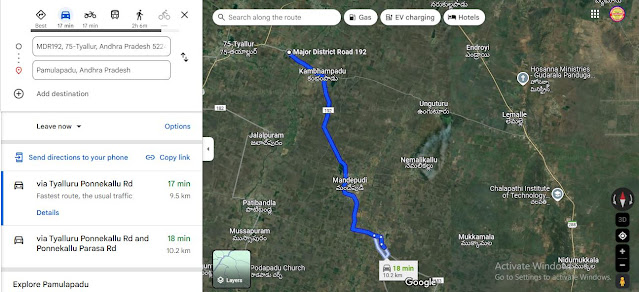
Mothadaka 9.5 KM ( Guntur Amaravathi Road)
Tadikonda 15 KM
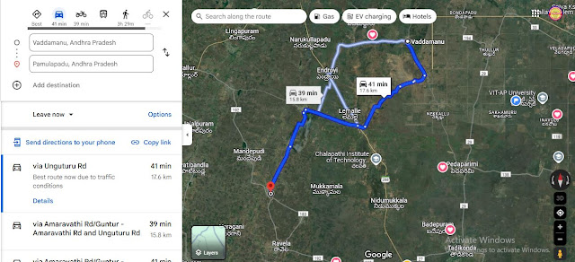
Vaddamanu 16 KM
Amaravathi Town 20 KM
Thulluru 28 KM
Guntur 24 KM
·
CRDA and RERA proposed layout.
·
An elegant Club house.
·
Avenue Plantation
·
Grand Entrance Arch.
·
100 % Vastu Plots.
·
8 ft compound wall with 2 ft solar fencing
·
3 lakh liters capacity Over head Water tank.
·
Tap connection to Each Plot & Name Boards.
·
24 hours Drinking water supply.
·
Electricity with Transformers.
·
Rain water Harvesting Pits.
·
Round clock security.
·
(Upto 50% BANK LOAN FACILITY)
·
Plots Sizes 150 Sq yds to 1000 Sq yds.
·
Underground drainage system
·
30,40 feet C.C ROADS
·
5 min to OUTER RING ROAD.
·
10 min to INNER RING ROAD.
·
15 min to AP ASSEMBLY.
·
15 min to AP SECRETARIAT.
·
20 min to AP HIGHCOURT.
·
20 min to IAS,IPS RESIDENTIAL BUNGALOW.
·
20 min to GUNTUR CITY.
·
25 min to SRM,VIT, AMRUTA UNIVERSITIES.
·
30 min to AMARAVATI TEMPLE.
·
40 min to VIJAYAWADA.
·
40 mins to GANNAVARAM INTERNATIONAL AIRPORT.
·
9 KM from TADIKONDA CROSS ROAD.
·
Surrounded with all RESIDENCIAL HOUSES &
APPARTMENTS.
Location Pin
https://maps.app.goo.gl/UMGvw2fDxjG5mRqV6
Pamulapadu Pin code is 522018 and postal head office is Ponnekallu .
Nemalikallu ( 3 KM ) , Mukkamala ( 3 KM ) , Varagani ( 4 KM ) , Ravela ( 4 KM ) , Patibandla ( 5 KM ) are the nearby Villages to Pamulapadu. Pamulapadu is surrounded by Pedakurapadu Mandal towards west , Medikonduru Mandal towards South , Amaravathi Mandal towards North , Thullur Mandal towards East .
Guntur , Sattenapalle , Mangalagiri , Vijayawada are the near by Cities to Pamulapadu.
Pamulapadu 2011 Census Details
Pamulapadu Local Language is Telugu. Pamulapadu Village Total population is 2561 and number of houses are 722. Female Population is 49.6%. Village literacy rate is 59.2% and the Female Literacy rate is 25.8%.
Amaravati Outer Ring Road – Information & Status
https://themetrorailguy.com/amaravati-outer-ring-road-information-route-map-status/
Explore the options for Amaravathi Industrial Corridor
Andhra Minister announces plans for new roads connecting
Amaravati with national highways
Amaravathi IT Tower
https://genesisplanners.in/commercial/amaravati-it-tower/
Andhra Pradesh Electronics Policy 2021 - 2024
https://apit.ap.gov.in/assets/files/electronicpolicygo_new.pdf
- The Krishnapatnam node in Andhra Pradesh is being developed as part of this corridor. A joint venture company, NICDIT Krishnapatnam Industrial City Development Limited, has been incorporated for this purpose.
- The Asian Development Bank (ADB) has prepared the Concept Development Plan (CDP) for this corridor. The four nodes identified for development are Visakhapatnam, Machilipatnam, Donakonda, and Chittoor. The Kopparthy and Orvakal nodes in this corridor have been sanctioned by the Union Government.
- The Chief Minister chairs the AP-ICDA Board, which is responsible for notifying industrial corridors and nodes, and approving their master plans. The board has 12 members, including the Industries & Commerce and Finance Ministers, and six secretaries from the Infrastructure and Revenue Departments.


Comments
Post a Comment